Breaking Down Israel’s Long-Range Strike Capacity
October 22 2014
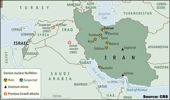
A Congressional Research Service report, dated Sept. 28, 2012, entitled “Israel:
Possible Military Strike Against Iran’s Nuclear Facilities,’ includes the above map.
This figure is labeled “Map of Major Iranian Facilities in Regional Context.” The
CRS adapted the map from the Economist (London). All locations are approximate.
Sources:
undefinedPlease log in to continue reading.
Not yet a subscriber? Take a free trial.
Military Periscope gives you easy-to-use, integrated, open-source intelligence on…
- More than 7,500 weapons systems and platforms
- Nearly every country's armed forces
- Militant organizations


Try Military Periscope free for seven days